2021 Fall Soybean Weed Survey
By Stephanie Karhoff (OSUE Williams County) and Chris Zoller (OSUE Tuscarawas County)
What are the most troublesome weed species in Ohio soybean fields? OSU Extension Educators sought to answer this question by surveying an estimated 204,641 soybean acres as part of the annual Fall Soybean Weed Survey.
Since 2006, OSU Extension has recorded weed escapes in soybean fields across the state to monitor weed population shifts and potential for herbicide development. Results also inform future weed management research and programming efforts. This article outlines results of the 2021 fall soybean weed survey.

Prior to soybean harvest, each participating Agriculture and Natural Resources (ANR) Extension Educator drives a circular route in their county observing on average, 100 fields. Species of weeds present, and to what extent, are recorded for each observed field. Infestation level is measured as either low, moderate, or severe.
This year, 36 counties participated in the survey and observed an estimated 3,625 fields with an average field size of 56 acres
Results are summarized by National Agricultural Statistics Service (NASS) reporting districts. Note, for 2021 no survey data was collected for the North Central region and only one county each for Southeast and South Central regions.
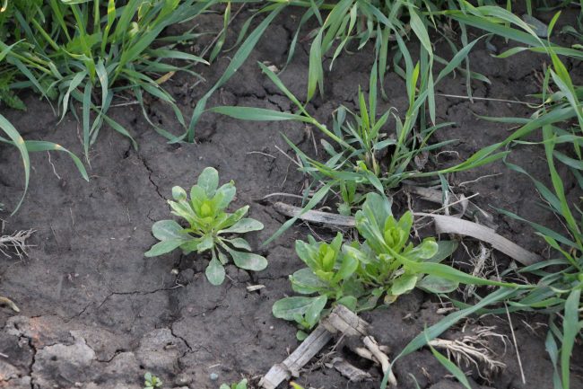
The top five weed threats in Ohio this year were volunteer corn, marestail, giant ragweed, giant foxtail/grasses, and waterhemp.
Volunteer corn was the most predominant weed statewide and was observed in 18% of total fields. West Central and Northwest Ohio had the highest levels of volunteer corn present at 22% and 20% of fields, respectively. Of the 641 fields where volunteer corn was reported, 9% had severe infestations; 30% moderate; and 61% low. Northwest Ohio had the greatest proportion of severe volunteer corn infestations.
Marestail and giant ragweed were tied for second place, with 17% of total fields reporting either weed species. In East Central and Northeast Ohio, marestail was present in more than a third of observed fields. Of the 603 fields where marestail was reported, 10% had severe infestations; 29% moderate infestations; and 62% low infestations. Giant ragweed was a common sight in Northwest, West Central, and Central Ohio this year; 69% of fields had low infestations while 18% had moderate infestations and 13% had severe infestations.
Across the state, 9% of surveyed fields contained giant foxtail/grasses. Northeast Ohio faced the highest level of weed pressure with 37% of surveyed fields containing severe infestations compared to statewide average of 12%.
Waterhemp rounded out the top five weeds and was observed in 8% of fields in 2021. Unfortunately, waterhemp continues to rear its ugly (seed)head in soybean fields in the western half of the state especially.

Of the 300 fields where waterhemp was observed, 13% had severe infestations, 22% moderate infestations, and 65% low infestations.
Compared to the 2020 survey, there was a 5% increase in volunteer corn reports. However, there was a 3% to 4% decline in marestail, giant ragweed and waterhemp. Levels of giant foxtail/grasses remained constant.
Just under half of observed fields were weed-free, a 4% increase from 2020. Perry County reported the highest percentage of weed-free fields and Paulding County the lowest.
Overall, Ohio soybean growers continue to manage weeds well, but the 2022 growing season will bring a unique set of challenges thanks to rising input costs and anticipated supply issues. See Weed Science State Specialist Mark Loux’s recent articles in the C.O.R.N. newsletter (http://corn.osu.edu) on how to adapt fall burndown treatments amidst potential glyphosate shortages.
For more weed management resources, join OSU Extension for one of seven regional “Weed Universities.” Dates and tentative locations are below. Contact Tony Nye at nye.1@osu.edu with questions or see the AgCrops calendar after the first of the year: https://agcrops.osu.edu/events/calendar.
Region Tentative Location Date
Northwest Paulding County February 3
Southwest Fayette/Clinton February 2
East Central Coshocton February 2
West Central Darke/Shelby February 3
South Adams/Brown February 3
Northeast Ashtabula/Geauga February 2
North Central Mt Gilead February 2